
Maps and Data
Grand River Information Network
You can access a variety of maps and data resources directly from the Grand River Information Network (GRIN) website. GRIN guides you to various interactive viewing and data download tools to help you quickly find the information you need.
Here are some of the tools and information you can access via GRIN:
- Applications: Use our interactive mapping applications to create your own maps of areas within the Grand River watershed. Ideal for creating maps of your property, study area, or for reports and school projects.
- Data: We maintain a collection of data available for download. You can download our GIS data (vector and raster) using simple download tools. Data from daily and hourly monitoring stations are also available for download including river levels, flows, and weather conditions.
- Web Services: Our data is also available through web-based Application Programming Interfaces (APIs). These tools help provide direct access to GRIN data without the need to download.
Static Maps
Please note the following documents may not be accessible to people with disabilities. If you have a disability and require a document in an alternate format, please contact us.
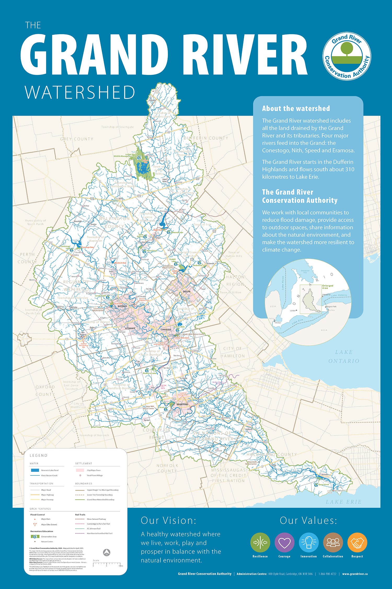
- Detailed watershed map poster:
This large map poster shows the physical and political features of the Grand River watershed, including GRCA parks and dams. (24 x 36 inches - 4MB PDF, published 2020.) - Smaller watershed map:
Basic overview map of the watershed with less detail. (11 x 17 inches - PDF 2 MB, published 2008) - Climate region map:
Climate regions of the Grand River watershed. (8.5 x 11 inches - PDF 4 MB, published 2008) - Forest zones map:
Forest zones of the Grand River watershed. (8.5 x 11 inches - PDF 3.5 MB, published 2008)
Other data sources
The GRIN site also offers data links to other agencies such as Water Survey of Canada, Environment Canada, provincial ministries and municipals. Go to the GRIN - External Resources page for more information.
Contact Us
Grand River Conservation Authority
400 Clyde Road, PO Box 729
Cambridge, ON
N1R 5W6
Phone: 519-621-2761
Toll Free: 1-866-900-4722
grca@grandriver.ca